
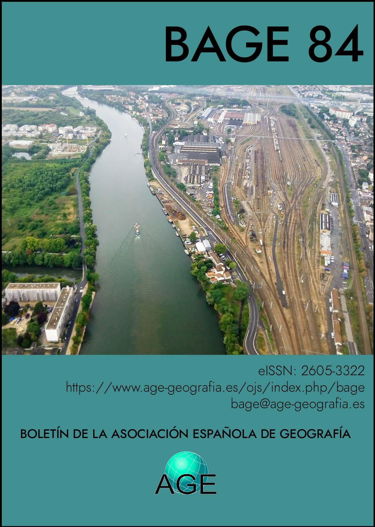
Aereal image of Villeneuve-Saint-Georges (August 2017)
Article Sidebar
Published:
2020-03-15 12:00 AM CET
Main Article Content
Abstract
Premio del Concurso de Fotografía de la Asociación Española de Geografía. Categoría docente
The accessibility of a place is determined by the transportation network. It is greater in the big cities: the network is more dense and the infrastructure is better and more diversified. This is the case of the southern periphery of Paris, near Orly airport, where this photo was taken. Here we can observe the fluvial and land transportation, an important train intersection and also several roads.
Article Details
Issue
Section
Photo
How to Cite
Aereal image of Villeneuve-Saint-Georges (August 2017). (2020). Boletín De La Asociación Española De Geografía, 84. https://bage.age-geografia.com.es/ojs/index.php/bage/article/view/2927